- Thumbnail
- Resource ID
- d1f3fa3e-6f6a-11e9-8d7d-000d3ab6a624
- Title
- TM-COLOMBIA-Geomorfología de fondos profundos-2013-100.000
- Date
- May 5, 2019, 2:20 p.m., Publication
- Abstract
- Este shape es el resultado de una integracion de varios procesos de analisis espacial, a partir de interpretacion de datos batimetricos y modelamiento de terreno,con un proceso de sintesis de clasificacion de unidades
CONVENIO INTERADMINISTRATIVO No 57 DE 2013 ENTRE EL MADS Y EL INVEMAR: ELEMENTOS TÉCNICOS Y GENERACIÓN DE CAPACIDAD PARA EL ORDENAMIENTO, CONSERVACIÓN Y MANEJO DE LOS ESPACIOS Y RECURSOS MARINOS, COSTEROS E INSULARES DE COLOMBIA.
Código: ACT-VAR-001-013
- Edition
- --
- Owner
- gridanode
- Point of Contact
- devrsgis@gmail.com
- Purpose
- --
- Maintenance Frequency
- None
- Type
- not filled
- Restrictions
- None
- None
- License
- None
- Language
- eng
- Temporal Extent
- Start
- --
- End
- --
- Supplemental Information
- No information provided
- Data Quality
- --
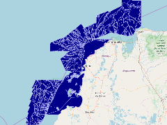
- Extent
-
- long min: -76.9865951538
- long max: -74.1038513184
- lat min: 8.8593845365
- lat max: 12.0332098003
- Spatial Reference System Identifier
- EPSG:900913
- Keywords
- no keywords
- Category
- None